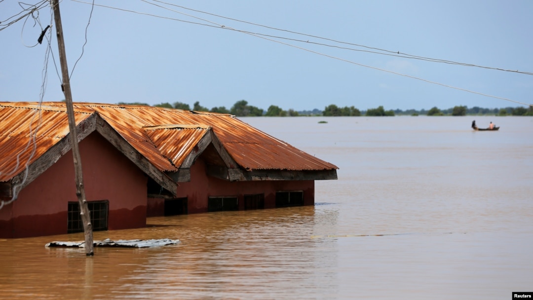

The Federal Government of Nigeria has warned that 28 states and the Federal Capital Territory (FCT), risk severe flood over heavy rainfall for the next two weeks.
It warned that the widespread flooding be experienced in hundreds of communities across the country.

The warning, contained in a statement by the Federal Ministry of Environment through the National Flood Early Warning Systems Centre, covers the period from July 19 to August 1, 2026.

The ministry said persistent rainfall, saturated soils, rising river levels and overstretched drainage systems are expected to increase the risk of severe flooding.
It noted that both northern and southern states remain vulnerable, with densely populated urban centres, coastal settlements and riverine communities in the South facing heightened threats of flash floods, river overflows and coastal inundation.
States classified as facing critical flood risk include Abia, Adamawa, Akwa Ibom, Anambra, Bayelsa, Benue, Cross River, Delta, Ebonyi, Edo, Ekiti, Enugu, Imo, Kogi, Kwara, Lagos, Niger, Ogun, Ondo, Osun, Oyo, Rivers and Taraba.
The ministry also identified major cities and commercial hubs expected to experience severe flooding, including Lagos, Lekki, Ikorodu, Agege, Apapa, Eti-Osa, Ikeja, Surulere, Badagry and Lagos Island.
In the South-East, vulnerable communities include Aba, Umuahia, Arochukwu, Onitsha, Awka, Nnewi, Nkpor, Obosi, Anambra West, Ayamelum, Omor, Nzam, Abakaliki, Afikpo, Enugu metropolis, Nsukka, Owerri and Orlu.
The South-South is also expected to be significantly affected, with flood alerts issued for communities in Bayelsa, Rivers, Delta and Cross River states, including Yenagoa, Port Harcourt, Warri, Asaba and Calabar.
The government warned residents in vulnerable communities across Akwa Ibom, Edo, Ondo, Ogun, Osun, Oyo and Ekiti to prepare for possible urban flooding that could disrupt transportation, damage homes and businesses, and destroy farmlands.
In the North-Central zone, Lokoja, Ajaokuta, Idah and Ibaji in Kogi; Makurdi, Agatu, Buruku, Guma and Logo in Benue; and Minna, Mokwa, Shiroro, Suleja and Bida in Niger State were listed as areas requiring close monitoring because of rising river levels and their proximity to floodplains.
The forecast also identified Yola, Mubi, Song, Ganye, Jalingo, Karim Lamido, Takum and Wukari in Adamawa and Taraba as communities that could experience severe flooding if the current rainfall pattern persists.
Beyond the critical-risk areas, Adamawa, the FCT, Kebbi, Nasarawa, Plateau and parts of Taraba were placed under high-risk surveillance, while 531 communities across Bauchi, Borno, Gombe, Jigawa, Kaduna, Kano, Katsina, Sokoto, Yobe and Zamfara were classified as moderate-risk areas.
The Federal Government urged residents living along riverbanks, floodplains, wetlands and drainage channels to remain vigilant and comply with warnings from emergency management agencies.
It also directed State Emergency Management Agencies, local government councils and community flood response volunteers to intensify monitoring of rivers, bridges, culverts and erosion-prone areas.
Residents in high-risk locations were advised to activate evacuation plans where necessary, clear blocked drainage channels, monitor rainfall and river levels, and promptly report flood incidents.
The ministry added that the forecast should be interpreted alongside local weather conditions and official emergency advisories as the rainy season reaches its peak.